Friday, June 26th - Up at 5:25, to overcast skies and 63 degrees, still and already very sultry. Looks like a day for heavy afternoon thunderstorms. After going to get water, we left at 6:15, with a wave to Journey. Mark's feet were still bothering him, even with his old boots, and by the time we got to the crest of the long hill he was semi-limping. Rather than continuing on (in pain) to Fayetteville or Pine Grove Furnace State Park, I suggested that we return to the Old Forge Picnic Area if Mark's mom or Brenda could come today. After a dozen tries, and moving around a bit, we finally got a viable cell phone signal, and arranged for Mark's mom to come get us this morning. So, we returned back down the hill to the Tumbling Run Shelter, passing Journey and the other hiker (forgot his name) on the way up. After eating breakfast on the picnic table there (and further discussing out decision), we pushed back to the Picnic Area, arriving just before 9:00 am. Despite the early hour, there were a (rapidly growing) number of Mennonites (???) already there, setting up what we guessed was a very large picnic on the baseball field. We moved up to a large pavillion, in case it rained, but in fact the day improved rapidly to nearly clear skies - but increasingly warm and still quite sultry.
We listened to the radio for awhile, then a group of about 50 kids and counselors from Camp Penn (a Methodist Church summer camp located right next door to the park) showed up, and so we moved to a free picnic table. The kids quizzed Mark for a few minutes about what we had done, and we were both kind of startled to get a several rounds of applause and cheers from the group. An unexpected accolade to end our trek on. Mark's mom showed up just before 10:30, and we loaded up and headed off to Waynesboro (this one in Pennsylvania) for brunch/lunch. The Golden Corral (our intended destination) didn't open til 11:00, so we instead went to the Mountain Gate Restaurant, enjoying both their breakfast and lunch buffets, while discussing our decision with Mark's mom. Then back in the car for the drive home (I semi-napped in the back seat). She dropped Mark off around 1:00, then myself at 1:30, thus ending our trek. [As a final aside, let me offer our collective thanks to Mark's mom, who was always "there" for us the entire trek.]
Joint Statement from Mark Wray & Bob Klein about leaving the A.T.:
We left the A.T. at the Old Forge Picnic Area in southern Pennsylvania on Friday, June 26th, after completing nearly 1100 miles (the southern half of the trail) during a particularly challenging year. We both decided that hiking and camping (being two of our favorite activites) were too important to us to be reduced to a daily chore. We have been told that some folks finish the A.T. merely to "get it over with," or for a plaque on the wall. This was never our intention or desire. At this time we don't have any plans for finishing the northern half of the trail. We may do it in sections over the next few years, we may take another long trek after we retire, or we may never finish. We are proud of our accomplishments, and enjoyed the time we had on the trail and our time together. And we have gained a new respect for those few that complete the entire trek. Thanks to everyone who supported us along the way. This was the toughest physical, mental, emotional, and spiritual challenge we had ever faced, but it was also a remarkable adventure. We hope others may someday follow in our shoes. See you "down the trail ..."
Saturday, June 27, 2009
Day 80 - Over the Mason-Dixon Line, & a Big Decision
Thursday, June 24th - Up at 6:30, to clear but hazy skies, and increased humidity. I got up a little earlier in order to complete yesterday's blog report. Mark got up just before 7:00, and prepped breakfast (sausage and scrambled eggs) for both of us (David and Carol declined - apparently, they rarely eat breakfast). Done by 7:45, and packed up and on our way just after 8:00, with thanks to Carol. David drove us back up to the trailhead, and with additional thanks for all the hospitality, and his wishes for good luck, we were back on the trail.
Today's trails were a repeat of yesterday's - some nice stretches, some nasty stretches, and again a lot of road crossings. There were also a lot of trail crossings, many of them unmarked (I guess you just have to know!) It was also noticeably hotter and more humid than it had been yesterday, or maybe we were just feeling it more. Mark's feet were better with his old boots, but he was still hurting. We passed a bunch of shelters today, set surprisingly close together and also close to local roads - Ensign Cowall, Raven Rocks, others, plus a PATC Cabin. We stopped at the trail junction for Raven Rocks, and I headed down about a quarter mile for water. Mark chatted with a northbound section hiker (Walker Kentucky Ranger) while I got the water. Contrary to what the book said, the spring was well before the shelter, and so I just got water and didn't bother checking the shelter register (the shelter was not in sight, and I didn't care to walk down
the (steep) hill any further). A little later we crossed a small stream that had a dozen sodas bobbing in the water - another Trail Magic. Just after High Rock Overlook, we stopped for lunch, with Walker Kentucky Ranger joining us; nice guy. He was completing Maryland that afternoon, then heading home. We pushed on down a very steep and rocky stretch - the northern end of South Mountain.
On the way down, however, Mark indicated that he wanted to leave the trail when we reached Pine Grove Furnace State Park, the halfway point. Quite a shock to me! We talked about it at length as we walked down the hill, and he explained his thoughts. In addition to several personal reasons (which I will not detail here), he strongly felt that the trek had become a chore, and simply wasn't fun or interesting anymore. Thinking about it, I agreed - and also knew that I had a serious question now, whether I should continue or quit. Having done the hundred mile stretch from Mt. Rogers Visitor's Center to Pearisburg alone, I was unenthused about another 1100 miles of the same - and one of the main reasons (probably THE main reason) why I had started the trek this year was because Mark was going. Needless to say, my mind was running about a hundred miles an hour for the rest of the day (and well into the wee hours of the morning) as I pondered my decision.
Eventually we reached Pen-Mar Park, at the Maryland - Pennsylvania border. A southbound section hiker told us that there was a Trail Magic going on at the park, but if so it was over and gone by the time we arrived. But it was a beautiful park, with a fabulous view to the north into southern Pennsylvania; they even had a grandstand set up for the view. Even though it was just a Thursday, there was a surprising number of people there. We took a soda break, and made a few more phone calls, before moving on, stopping for photos at what we think was the actual Mason-Dixon line on Pen-Mar Road. The trail improved dramatically as we headed into Pennsylvania, and we also passed several shelters: Deer Lick and Antietam, the latter having two small shelters side by side. We reached another park, the Old Forge Picnic Ground, and stopped for dinner there (another nice spot). After a half an hour, we pushed on to Tumbling Run Shelter, another two-shelter setup with nice tent sites and both a creek and a spring nearby. There were two hikers there, a female northbound section hiker Journey (a different Journey than the one we had hiked with in southwestern Virginia), with her dog, and a male northbound through-hiker (missed his name).
Due to the bug issue, we decided to tent-camp (as did the other through-hiker). Mark wanted to call Brenda, but there was no cell phone coverage near the shelter, so I set off up the next hill (still on the A.T.), reaching the crest about 20 huffing and puffing minutes later. The issues with U.S. Cellular continued, but eventually I was able to get some calls through. Coming back down the hill, I met Mark coming up - he doubtless thought I had been eaten by a bear or something, I was gone so long. He headed up himself, and I went down and had a nice chat with Journey, discussing whether to quit the trek or not (she was very sympathetic, and also very complimentary of what we had already done). As darkness came on, I went over and yelled up to Mark - and he answered, so no need for me to head back up the hill with my flashlight. After laying out the Spot, and recording the blog entry, we hit the rack around 9:20. So, 18 miles total, plus the extra mile to get up and down the hill for phone calls. Mark fell asleep fairly quickly, but I lay there til about 1:30, still agonizing over my choice to continue or quit. In the end, however, I decided it was the end for me too - though I could do it solo, and would have gone all the way with Mark, I just wasn't interested in doing it alone. I guess there was some relief in that, and I fell asleep soon thereafter. A tough day, physically, mentally, and emotionally.
Day 79 - A Nero into Smithsburg
Wednesday, June 24th - Up at 5:15 (first ones up), another perfectly clear morning, 58 degrees, no noticeable breeze. On our way at 6:00, again walking the South Mountain ridgeline crest. Within a half an hour, we crossed over Boonsboro Road, then entered the Washington Monument State Park - another very nice facility. Since there were numerous picnic tables and another full-service bathhouse (that was open), we stopped for a quiet breakfast, with only a rabbit and a sizable murder of crows to keep us company (the entire place was completely deserted, as you'd expect for a Wednesday morning). 

Once we wrapped that up, we headed up the hill to the actual monument, grabbing some water and reading the various plaques along the way. The A.T. split off about halfway up, but we continued on the historical trail to the monument, which we then climbed for the views. After a few pictures, we returned to the trail and continued on our way. It was a real mixed bag on the trails today - some easy stuff, some brutally rocky stretches. We also crossed over a half a dozen roads today, some of them quite busy. Mark's feet are really bothering him - apparently his new boots are too narrow, and are causing him serious pain, especially on the rocky areas.
We reached the Pine Knob Shelter; we dropped our packs and Mark headed down for water and to check the register. Later we passed the "Pogo" primitive campsite; it had a spring there, but otherwise it wasn't a good place to camp (no level tenting area, lots of rocks). Later we threaded our way through a small residential zone, just before I-70, with the trail running along the property lines of several houses. There was also a trail log there (which we signed); again, very few familiar names over the previous two weeks - most of those signing in are section or weekend hikers. I am beginning to wonder just how many through-hikers are actually out here any more - people who should have easily passed us during our 4-day home visit are not in any of the trail registers, and only about half a dozen of the folks we knew (who had passed us earlier in the trek) are still ahead of us.
Once we passed over I-70 (on the long overhead footbridge that the Troop has gone under a hundred times in my career), we were back in the woods for awhile. Climbing back up the ridge on the opposite side, we were both quite surprised to catch up to Rush Williamson, a Scoutmaster from Maryland and a Contingent Leader for the first one of the Council's Philmont trips this year (Mark knows him very well). He was heading up to Annapolis Rocks to repair the privvy there (and also as a personal shakedown for Philmont). He had through-hiked the A.T. and had more than an hour's worth of advice for us. He split off at Annapolis Rocks, and we continued on. Mark decided to try and get his previous set of boots overnighted to his cousin's house (our destination for the day); after a lot of phone calls (from the top of the ridge), we finally got through, and his mom decided to bring them up to Smithsburg herself. [It was fortunate that we're still close to the Washington area.] The phone coverage in this zone is U.S. Cellular, and (apparently) it doesn't like Verizon very much, so making and receiving calls and voicemails was problematic, requiring multiple attempts.
It got noticeably hot as the afternoon came on, and we had to really hit the water as we were going along. But it wasn't all that oppressive, just hot. Finally descended down to Wolfsville Road, where Carol Fitzgerald picked us up, and 3 minutes later we were at their house (a nice place, set 300 yards back in the woods). So, only 13 miles today, though it felt longer to me. Mark's mom was already there, with Mark's boots, and (after some showers and a load of laundry) we all chatted for a while. David Fitzgerald showed up about an hour later, and Carol took off for an evening function. We headed off with David to a mini-mart and then Food Lion to resupply (and buy some dinner items), then returned to the house. Mark prepped hamburgers on an outside grill for dinner while I did a quick check of email. We continued chatting with David and Mark's mom over dinner about the trail, and then I headed up for bed around 7:00 - for some reason I was really staggering with fatigue today, probably due to the heat. Mark's mom left for Arlington about the same time. David offered to clean everything up, which was greatly appreciated, and he and Mark talked for several hours as I caught some extra sleep. A nice break!


Once we wrapped that up, we headed up the hill to the actual monument, grabbing some water and reading the various plaques along the way. The A.T. split off about halfway up, but we continued on the historical trail to the monument, which we then climbed for the views. After a few pictures, we returned to the trail and continued on our way. It was a real mixed bag on the trails today - some easy stuff, some brutally rocky stretches. We also crossed over a half a dozen roads today, some of them quite busy. Mark's feet are really bothering him - apparently his new boots are too narrow, and are causing him serious pain, especially on the rocky areas.
We reached the Pine Knob Shelter; we dropped our packs and Mark headed down for water and to check the register. Later we passed the "Pogo" primitive campsite; it had a spring there, but otherwise it wasn't a good place to camp (no level tenting area, lots of rocks). Later we threaded our way through a small residential zone, just before I-70, with the trail running along the property lines of several houses. There was also a trail log there (which we signed); again, very few familiar names over the previous two weeks - most of those signing in are section or weekend hikers. I am beginning to wonder just how many through-hikers are actually out here any more - people who should have easily passed us during our 4-day home visit are not in any of the trail registers, and only about half a dozen of the folks we knew (who had
 passed us earlier in the trek) are still ahead of us.
Once we passed over I-70 (on the long overhead footbridge that the Troop has gone under a hundred times in my career), we were back in the woods for awhile. Climbing back up the ridge on the opposite side, we were both quite surprised to catch up to Rush Williamson, a Scoutmaster from Maryland and a Contingent Leader for the first one of the Council's Philmont trips this year (Mark knows him very well). He was heading up to Annapolis Rocks to repair the privvy there (and also as a personal shakedown for Philmont). He had through-hiked the A.T. and had more than an hour's worth of advice for us. He split off at Annapolis Rocks, and we continued on. Mark decided to try and get his previous set of boots overnighted to his cousin's house (our destination for the day); after a lot of phone calls (from the top of the ridge), we finally got through, and his mom decided to bring them up to Smithsburg herself. [It was fortunate that we're still close to the Washington area.] The phone coverage in this zone is U.S. Cellular, and (apparently) it doesn't like Verizon very much, so making and receiving calls and voicemails was problematic, requiring multiple attempts.
It got noticeably hot as the afternoon came on, and we had to really hit the water as we were going along. But it wasn't all that oppressive, just hot. Finally descended down to Wolfsville Road, where Carol Fitzgerald picked us up, and 3 minutes later we were at their house (a nice place, set 300 yards back in the woods). So, only 13 miles today, though it felt longer to me. Mark's mom was already there, with Mark's boots, and (after some showers and a load of laundry) we all chatted for a while. David Fitzgerald showed up about an hour later, and Carol took off for an evening function. We headed off with David to a mini-mart and then Food Lion to resupply (and buy some dinner items), then returned to the house. Mark prepped hamburgers on an outside grill for dinner while I did a quick check of email. We continued chatting with David and Mark's mom over dinner about the trail, and then I headed up for bed around 7:00 - for some reason I was really staggering with fatigue today, probably due to the heat. Mark's mom left for Arlington about the same time. David offered to clean everything up, which was greatly appreciated, and he and Mark talked for several hours as I caught some extra sleep. A nice break!
Day 78 - Back at it; Goodbye West Virginia, Hello Maryland
Tuesday, June 22nd - Got up at 5:30 and grabbed a final (pre-trail) shower. Then checked email, discussed a few final issues with Marco, and headed off to McD's for a quick breakfast. Back to the house at 6:45, and finished my packup by 7:00. Mark and his son William showed up at 7:20, and we headed back to Harper's Ferry, arriving at the 340 bridge parking lot around 8:30. Beautiful day, clear blue skies and low humidity, with a light breeze. We loaded up and headed out by 8:40, with William departing as we walked away.
We started out along the river for a bit, passing Jefferson's Rock (nice views), then walking through a bit of the Harper's Ferry Historic District (spending a few minutes to read the various plaques along the way). Eventually we crossed the Potomac on a footbridge adjacent to the railroad bridge, entering Maryland (our sixth state!) Walked along the C&O Towpath for roughly 2 1/2 miles, where we saw a turtle attempting to lay eggs (another first for me); there were also some very large mud turtles sunning themselves on logs and rocks in the canal itslf (which was green ooze here). Eventually we cut left over the canal and started up the long climb up South Mountain (which runs nearly across the entire state). The trail runs down the center of the ridge, which is fairly wide and flat. Some nice trail, but also some really rocky sections. Passed (but did not stop at) two shelters along the way, Ed Garvey and Crampton Gap, and then entered Gathland State Park (nice facility).
After getting water and chatting with a few other through-hikers there (none who we knew), we pushed on to Rocky Run Shelter. By this point (early afternoon), it was getting pretty hot, so we dropped our packs and Mark went on down to fill up on water again, and enter us in the register. Happy had been there on the 12th, and Fidget on the 15th - no one else we recognized in the register. Several people at the shelter indicated that our intended destination (Dahlgren Backcountry Camping Area) had some sort of mini-Boy Scout Camporee going on, but we decided to risk it. Arriving around 6:00, we did in fact find one Scout group in residence (Troop 439 out of southern New Jersey), but the other (larger) group was a YMCA youth group. There were eventually a dozen other section and through-hikers camping there. For the day, 17 miles done. The site itself was very nice - a wide lawn, with picnic tables situated on gravel pads, and a full-service bathhouse. And a small rabbit. Despite the name, not exactly a primitive site! There was still plenty of space, so we went ahead and set up, then ate dinner, then went and chatted with the Scout leaders from Troop 439 (they were impressed with our encyclopedic knowledge of Philmont, which they had attended 3 times over the past 15 years). Mark also chatted with several of the other hikers in residence, while I made the diary entry for the day. By this point we had some thin clouds overhead, but it was still very pleasant. Bed by 9:00. A good day, and a good start to the second half of the trek.
Saturday, June 20, 2009
Day 77 - Off the Trail for a Few Days ...
 Friday, June 19th - Up at 6:30, after watching a re-run of the Nationals win over the Yankees (3 - 0!) 'til after midnight. Took another shower, then went out and checked various email accounts on the hotel courtesy computer. Returning to the room around 7:30 or so, Mark got up and we hit the Continental Breakfast - decent, nothing special. Fortunately for them, we had stuffed ourselves at the Chinese buffet last night, so we behaved ourselves.
Went back to the room and started packing (holding our noses). Got a call from Pete at 8:30 - he was already in the parking lot, and had been there for about 15 minutes. So we hustled our gear outside and loaded up, with greetings all around. Since the ATC Center didn't open til 9:00, and Pete hadn't eaten yet, we started heading to Charles Town to grab breakfast - but eventually turned back around and returned to the Center. In fact it was already open (8:50), and so we spent about half an hour there, signing in, getting our "official" through-hiker photos for their 2009 album, and buying the maps for the rest of the trip (I suppose this means we're committed now!) Eventually Pete headed up to a local 7-11 (with another through-hiker - Spoonman) for some something to eat - he bought the through-hiker his breakfast too (instant trail magic!)
Once he returned, we loaded up and headed to Mark's house (in Chantilly), then to my house. I talked with Rick K. (from my agency) on the way - apparently my position had opened up yesterday, so I can now re-apply for my job (which I'll probably do, though apparently there are some 15's in other agencies that are intriguing). Traffic on both 28 and I-66 was heavy and slow, even though it was going on 10:30 by this point - some things I sure don't miss. Pete and I enjoyed a nice chat (He was nearly catatonic, but we did have a nice chat!) on the way to my house, and we arrived just before 11:00. After dumping my stuff, Pete headed off for work at Ireton, and I started in on a "serious" cleanup. Lots to do over the next 4 days. We're back at it again on Tuesday morning. [This blog will not cover the next 3 1/2 days spent at my house.] See ya!
(Ed. - Our intrepid friend has completed 1013 miles in 76 days - an average of 92.1 miles per week and 13.3 miles per day. That's pretty close to 11 Philmonts back to back! If they maintain this pace, they'll summit Mt. Katahdin, the northern terminus of the A.T., on Rosh Hashanah, September 19th, although I suspect that it will probably be 10 days or so before that given their recent pace. My prediction? 9/9/9!)
Day 76 - By the Rollercoaster & on to Harper's Ferry
 Thursday, June 18th - Up at 5:30. Despite the heavy rains overnight, we woke to partly cloudy skies, and 65 degrees - but extremely humid (soupy is the best way to describe it). Doc McCorkle and Fantasy Feet also got up, soon after Mark and I. Got out at 6:10, and continued the ups and downs of the Rollercoaster, again on sloppy and slippery trail. Breakfast after an hour, on some convenient "sitting" rocks.
The trail stayed rocky til we passed Bear's Den and Rt. 7, then became a bit more reasonable (we decided not to visit Bear's Den Hostel). The gaps were again flowing hard with water. This was very familiar territory for both Mark and I, from various Philmont and other Scouting outings through the years. The temperature rose a bit, but it was still very humid. Around 11:00 we started getting distant booms of thunder, and within 30 minutes we were in yet another torrential downpour. Mark and I both elected to walk through it without rain gear, thereby getting a free (and badly needed) shower; however, the rain also finished the job of completely soaking our boots and socks - so we ended up hiking soaking wet the rest of the way.
Because the creeks were running pretty brownish after all the rain, we held out on water, finally filling up at the Blackburn Trail Center (potable water; Mark went down and filled our canteens). The trail improved dramatically after the Blackburn Center. We pushed on to the David Lesser Shelter (another nice one), where I went down to sign the register. Fantasy Feet was already there (having passed us about 2 hours beforehand). The Register indicated that Happy had been there on the 9th, and Rusty on the 15th; I didn't know anyone else in the listings. After a short break for snacks, we pushed on for the last 8 miles, passing Rt. 9 on the way. The sun came out, and the air was distinctly drier.
We continued on to the Loudoun Heights area, then headed down the switchbacks towards Harper's Ferry. Much to our surprise, about halfway down we met John Kaluta and his friend Melissa, waiting for us to arrive. After greetings, we declined their offer for a ride to the Comfort Inn, and so they took off for the parking lot near the 340 bridge while we walked in (23 miles total for the day, nearly 70 miles over the past 3 days). We crossed the bridge (noisy and busy), threw our packs in the back of John's car, and he drove us the final hundred yards from the A.T. to the hotel. We shared a couple of beers and then checked in, getting Room 109.
After showers and fresh clothes (and some first aid for our feet), we headed to Charles Town for a Chinese all-you-can-eat buffet there, closing the place down at 9:30 (pretty good food, but not as good as the Ming Dynasty at Waynesboro). Back to the hotel, where John and Melissa soon took off. Called Pete to finalize our pickup tomorrow morning; also called Marco to let him know when I'd be returning. We placed our most malodorous items in plastic bags, so the room wouldn't be too nasty, then watched a little TV (History Channel, then a Nationals/Yankees game re-run), then hit the Internet on the computer in the hotel lobby. Then bed. A good day, but we're both very weary.
Day 75 - Our Longest Day & Into the Rollercoaster
Wednesday, June 17th - Moderate rain started up around 3:00 am. Up at 5:30; still raining, so we decided to eat breakfast at the shelter as opposed to on the side of the trail in an hour (which is what we normally do). Left around 6:15, in the rain. The weather today was odd in that we had a lot of wind from the east and northeast, which I associate with nor'easters, not with cold fronts approaching from the west (which is what we had expected from the Weather Channel forecast). Regardless, it blew pretty hard, basically all day long, making the more exposed sections of the hike pretty chilly.
The trails were a mixed bag today, reasonable to start but difficult (later) as we headed into the Rollercoaster. We passed several shelters along the route today - Manassas Gap, Dick's Dome, and Rod Hollow. At 4:00, rather than sit at Rod Hollow (20 miles in), we decided to push on another 7 miles to the next shelter. The rain kept up nearly all day, with a few peaks of sun mid-day and then late afternoon. We saw only one other hiker all day, a southbound day-hiker. So not the best hiking day; the trails were pretty much a slick mud-pit (always a joy), and each gap had a pretty good flow of water pouring through it. We passed Rt. 55, then I-66, then Rt. 50, then Sky Meadows State Park, all familiar territory for both Mark and I. Eventually we passed a sign for the Rollercoaster (basically an "Abandon Hope All Ye Who Enter" sort of thing), and pounded up and down the first five peaks (lot of rocky trail), arriving at the Sam Moore Shelter at 7:30. Drizzle was still falling as we arrived, and we were both pretty much a wet mess. "Doc" McCorkle was there; that was it (he was, however, happy to see us, and was also astonished at our mileage (27 miles for the day)). A bit later "Fantasy Feet" arrived, and that was it for the night.
 and each gap had a pretty good flow of water pouring through it. We passed Rt. 55, then I-66, then Rt. 50, then Sky Meadows State Park, all familiar territory for both Mark and I. Eventually we passed a sign for the Rollercoaster (basically an "Abandon Hope All Ye Who Enter" sort of thing), and pounded up and down the first five peaks (lot of rocky trail), arriving at the Sam Moore Shelter at 7:30. Drizzle was still falling as we arrived, and we were both pretty much a wet mess. "Doc" McCorkle was there; that was it (he was, however, happy to see us, and was also astonished at our mileage (27 miles for the day)). A bit later "Fantasy Feet" arrived, and that was it for the night.
 The rain picked up steadily after we arrived, and so it was pretty noisy (but dry) under the tin roof of the shelter. Later overnight we had a major thunderstorm roll through, and still later a second very heavy batch of rain (but no thunder and lightning for this second batch), both with torrential downpours and lots of wind. So it was not the most "restful" night. We're both whipped, but also elated at having done 27 miles through some tough terrain and tough conditions - good to know we can handle high mileage days when we put ourselves to the test. And we're now within striking distance of Harper's Ferry!
Day 74 - We Depart the Shenandoahs
 Tuesday, June 16th - Up at 6:30, and (once Bill fired up his laptop) I checked email for a little while. Accepted invitations from Pauline and Ted for various picnic-parties going on this Saturday night (I'll try to hit both if I'm still conscious). Reasonable looking day outside to start, nearly 70 degrees to start - it will be cooler on the mountaintops, though). Mark got up around 7:30, and also checked his email. Bill prepared us an excellent (and large) breakfast (he's a pretty good cook!)
We loaded up just after 8:00, and headed back up to Gravel Spring parking lot, arriving about 9:05 or so. It was a very misty/foggy drive on the way up, and only 61 degrees when we arrived. There were two females in the lot when we showed up; they were awaiting a shuttle ride, and thought we were it - apparently, the guy was supposed to have been there at 8:30, so they were getting a little antsy. Even my phone had zero bars, so we couldn't help them, but Bill was willing to give them a ride if they were giving up on the guy (I don't know how that played out). We saddled up and - after a few photos and a lot of thank-you's - we headed back up the trail.
We had a couple of stiff climbs to start, over South and then North Marshall peaks, then over Compton Peak, kicking out a few deer on the way. The weather cleared up pretty well, to mostly sunny skies. But it was pretty humid yet. At Compton Gap, we separated for the last time from the Skyline Drive, and headed towards the north end of the park (about 2 miles north). We knew we had reached the park boundary when we passed another self-serve entrance station. The trails then became a mixed bag of "good" and rocky. We stopped at the badly named Tom Floyd "Wayside" - which in fact is just another shelter, not a real wayside such as those in the Shenandoah National Park - signed in, and moved on.
Approaching Rt. 522, we passed the National Zoo's Conservation & Research Center (surrounded by an 8 foot chain-link fence - Ed. The CRC just had the first litter of Clouded Leopard cubs born in captivity in 16 years); we did not see any animals, exotic or otherwise. In addition, although we passed several trails along the way, there was no sign for the Front Royal 4-H Center (home of the Hike-o-Ree). Crossed Rt. 522, came up a long incline and th en a long flat, passing the Mosby Primitive Campsite (we didn't stop). Finally arrived at the Jim n Molly Denton Shelter (near 6:00) - a very impressive place, with a separate (covered) eating area, privvy, bear pole, campsites, spring, etc. Probably the most impressive "total" shelter we have seen to date, even though the shelter itself was only medium sized. No one there. We checked the weather band radio, and heard that heavy rain showers were expected after midnight, so we elected to stay in the shelter (also, the bug problem here was minimal compared to some shelters we had stayed at the past week or so). "Lone Wolf" (another through-hiker who we hadn't seen before) showed up a while later, then two southbound section hikers came in around 8:30; that was it for the night. So, between 18 and 19 miles done today - not bad since we hadn't started til 9:15. However, tomorrow sounds like it will be a slog.
 en a long flat, passing the Mosby Primitive Campsite (we didn't stop). Finally arrived at the Jim n Molly Denton Shelter (near 6:00) - a very impressive place, with a separate (covered) eating area, privvy, bear pole, campsites, spring, etc. Probably the most impressive "total" shelter we have seen to date, even though the shelter itself was only medium sized. No one there. We checked the weather band radio, and heard that heavy rain showers were expected after midnight, so we elected to stay in the shelter (also, the bug problem here was minimal compared to some shelters we had stayed at the past week or so). "Lone Wolf" (another through-hiker who we hadn't seen before) showed up a while later, then two southbound section hikers came in around 8:30; that was it for the night. So, between 18 and 19 miles done today - not bad since we hadn't started til 9:15. However, tomorrow sounds like it will be a slog.
Tuesday, June 16, 2009
Day 73 - A "Nero" into New Market
Monday, June 15th - Up at 5:45, to a thin overcast and 57 degrees. Our tents dried overnight, and so were noticeably lighter. Gone by 6:15, continuing up a long but gradual slope. Again kicked out a few deer along the way, including one that allowed us to walk right up to it before moving just barely to one side. Made it to the Elkwallow Wayside at 8:25, where the manager was kind enough to open his restrooms for us, even though they didn't open til 9:00; we also got water there, and ate some of our snacks.
Moving on, we climbed Hogback Mountain, another long climb. Called Bill Rogers from the top (barely one bar even there), and he agreed to meet us at noon at Gravel Spring Gap Parking Lot. He was at a storage lot with the police, as someone had broken into his trailer (and several others also located there) the previous night, and stolen a number of valuable items, including his TV and stereo system. As you might expect, he was pretty aggravated, but insisted that he was OK with our plan to meet. We continued down the trail, stopping at Gravel Spring Hut at 11:15 or so for Mark to sign us in and get some water. Then a brief walk to the parking lot. Bill arrived at 12:05, just as the weather began to look threatening again (but no rain this time). Greetings all around, then we loaded up and headed off to Front Royal for lunch (McD's) and a stop at the Post Office (for Mark to pick up the next bunch of maps that he had mailed to himself). Then down I-81 to Bill's house in New Market (a pretty long drive).
We grabbed some showers, and also did our laundry. Bill and Mark watched a movie (Midway) while I made some phone calls and later typed up some blog reports. Around 6:00 we spent a few minutes drafting up our food lists, and then headed off to the Johnny Appleseed restaurant for dinner (a locally famous restaurant; excellent food and service). We spent a very enjoyable hour there, chatting with Bill about the trail. I grabbed my food supplies at a nearby Mini-Mart, then we headed up the road for Mark to get his food at a Food Lion. We headed back to the storage lot (site of the break-in), where Bill installed a couple of new locks on his trailers, and showed us the damage (sad). Back at the house, we sorted food and laundry, and I continued typing blog reports til 10:45 or so, while Bill and Mark watched TV. A good day - only 11 miles done, but a nice break. Back at it tomorrow.
Day 72 - Lots of Wildlife, & a Good Deed Done
Sunday, June 14th - Up at 5:30, to clear skies and considerably cooler, 46 degrees, with a steady breeze blowing. It seemed that a cold front must have come through overnight, as the air was noticeably drier. Despite the wind and lower humidity, our tents remained wet overnight, and so it was (as expected) a wet packup and heavier than usual packs.
Left at 6:10, accessing the A.T. about a hundred feet from our site. Just as we reached the trail we kicked up a skunk - an unusual skunk in that it was nearly all black with just a tuft of white on it (I've never seen one like that before). It hustled away without giving us a spraydown, for which we were certainly thankful. Reaching Rock Spring Hut, Mark dropped his pack and hustled down to sign us in (Bon-Bon was there, but she was the only one of about 8 people there that he recognized). We kicked up a lot of deer along the trail today - at least 15, including a nice 6 point buck still in velvet (near Pass Mountain), and also a doe with a small fawn near Big Meadows. In general, all the deer in the Park are nearly heedless of humans, and barely will get out of your way as you walk up on them. Later we also kicked out a small bear cub, maybe 25 pounds, but fortunately it moved away quickly and mama (wherever she was) didn't make an appearance.
Then we came across Doc McCorkle (sp?), a fellow through-hiker, who was searching for his glasses (he had knocked them off his head while hurriedly setting up his tent just before the rain the previous night). He had been searching for them for hours, and asked if we would help him look. Of course we agreed, and as luck had it I found them about 2 minutes later. One lense had popped out, but Mark repaired that with an eyeglass kit we had in our first aid supplies. "Doc" was extremely grateful. I told him to be sure to keep his second pair with him from now on, and he agreed.
By mid-day it had turned into a beautiful day, with clear blue skies and low humidity, one of the better days on the trek. We eventually reached Skyland, and we hit the Lodge for some OJ Mark) and a Coke (me), while Bob-Bon (who had passed us a few minutes before) had a blackberry ice cream pie. We all chatted for about half an hour before pushing on. We ate lunch at the Pinnacles, under the pavillion there. At least 20 other people were there, even though it was now past noon on Sunday (obviously the nice weather was causing people to delay their returns home). Then on to Mary's Rock, passing by numerous overlooks of the valley and the Massanutten range along the way. Since we had both been to Mary's Rock numerous times, we decided to pass on it (it's off a side trail), and headed down to Thornton Gap. The trail down to the gap is considered to be the worst in the Park, and it lived up to its reputation, rocky and nasty. So we were pretty beat up by the time we made it down. The Panorama Restaurant is no more, having been completely eradicated, but the Park Service had erected a nice bathroom in its place, which was also a good water source.
We passed over Rt. 211, and continued on to Pass Mountain, on MUCH nicer trail. We reached the hut around 5:00, and decided to continue on (Mark again went down to get water and sign us in). So we kept hiking 'til about 6:45, finding a reasonable but not a great site about 25 yards off the trail. It was also noticeably slanted, but we've slept on worse, many times. Our tents were still wet from last night, but we were able to mop the floors dry enough to avoid any problems. Biggest issue with the site (in fact all day) were the large number of little black flies and gnats, which made our lives miserable every time we stopped (and guaranteed we would not stay in a shelter). Mark actually ate wearing his rain gear; I just killed a hundred of the things and called it even. Anyway, it was again a quick dinner and into the tents by 8:00. So about 21 miles in, another good day.
Day 71 - Swift Run Gap to Big Meadows
Saturday, June 13th - Up at 5:15, with the intention of typing blog reports - unfortunately both my troop111.org and my mailsnare accounts refused to allow me access. Eventually I sent one report to Pete via Kim's email system, but that was it. Jim got up around 7:00 to make us breakfast (omelets, sausages, and biscuits, quite a meal), and Mark came in around 7:30 or so. We were pretty stuffed by the time we finished. It was a misty, sultry day outside, with the mountains barely visible. Once we were done eating, we quickly packed up, and Jim and Kim took us back up to Swift Run Gap, arriving about 9:25. Did our final goodbyes and thank yous, and got going immediately.
Right after we started, we began seeing signs for a Trail Magic at a Ranger Station, but being that we had just eaten a huge meal we passed on by. Pretty decent trail today, and extensive signs of trail maintenance along the way, including a couple of guys who were weed-whacking the brush. But also some significant climbs, and we were soon dripping wet again with the heat and humidity. Came into Lewis Mountain Camp, and we stopped briefly so Mark could snag a Pepsi at the camp store (I stuck with water). Just as we were leaving, Bob-Bon came by and also decided to hit the various facilities. We continued on to Bear Fence Hut, where Mark went in to check the Register and sign us in as passing by. He noted that Salty had written an acknowledgment that Thunderpants and Sis had left the trail, so I guess they must have called him. He confirmed that he was heading on alone; unfortunately, with our upcoming 3-day break coming up, we're quite unlikely to see him again (which is, of course, the way of things out here). Too bad; he's a good guy to hike with.
Continuing on, we were both struck by the groups of people on the trail and especially the number of vehicles on the Skyline Drive (including a large number of motorcycles). I guess I wasn't expecting this many people in the Park before the Virginia schools let out. Quite a difference from mid-week. We talked with several of the groups, and were suitably gratified by the oohs and aahs from everyone who were impressed that - yes - we had walked here from Georgia. The last 5 miles to Big Meadows seemed to pass by slowly - it was a long uphill for basically the entire day, and we were feeling it by this point. Arriving at the camp (5:45), we were unhappy to find various "Area Closed" signs on the trail, due to the local peregrine falcon nesting sites. That was fine, but there were no instructions for through-hikers, and so we ended up having to bushwhack into the camp - ridiculous!
Eventually we made our way to the Camp Office, where we were fortunate to get the last campsite left in the camp, E181, all the way on the east edge of the campground. Lucky for us, though we could have pushed on to the next shelter (about 3 more miles) had the campground been sold out. But another 5 - 10 minutes and we'd have had no choice. We set up quickly, chatted up a few of the neighbors a bit (they were also impressed that we were through hiking), and ate dinner. Then we started hearing distant thunder and the horizon turned dark rather quickly (7:00), so the long threatened thunderstorm had arrived. And moving fast too - we barely had time to get our stuff and ourselves under cover before heavy rain began falling. I took the opportunity to do a bandanna cleanup at the bath-house. Fortunately the heavy rain lasted less than half an hour, but more than enough to ensure a wet packup and heavier packs tomorrow. It did seem much cooler afterwards, so we stayed in our tents for the night (around 8:00 pm). Both our tents stayed dry throughout the downpour, so we're pretty happy with them. Unfortunately our nearest neighbors (the ones we had not talked to) decided to hold a singalong 'til just after midnight, plenty loud enough to keep both of us awake. They finally quit just as I was getting dressed to go do an aggravation dump. A good day otherwise, about 17 1/2 miles.
Day 70 - On to Swift Run Gap & Favorite Stump Farm to visit the Smiths
Friday, June 12th - Up at 5:30, 57 degrees, some high clouds and a breeze. Everything wet from last night's rain, so packup was a bit slower. Gone at 6:10, dropping off Mark's trash and our campsite tag on the way. Filled our water bottles at the camp store, and then back on the trail. Very wet hiking from the waist down, as the trail was very thick for the first 2 miles or so. Also, a few more steeper sections today - but overall we moved pretty fast again.
Breakfast at a nice rock cropping; good view. Picked up water at Pinefield Hut (Mark signed us in there, and noted a message from Salty: "Thunderpants and Sis, where are you?") It was getting hotter and more sultry as the day wore on, so we poured the water in pretty steadily. Lunch was in the parking lot at Powell Gap, under a few light sprinkles. Then a long climb up to High Top, stopping for a break at the hut there. There were also two nice overlooks as we approached the crest. Coming down the north slope, we passed a Philmont Crew heading up, a Troop 1 from somewhere in North Carolina; they were pounding right along, so no chance to chat.
Got to Swift Run Gap around 2:50, good time, and walked down to just outside the Entrance Station. Laid out the Spot, then called Jim and Kim both to let them know that we had arrived; only got their answering machines. But then they pulled in 5 minutes later, so perfect timing. After loading up and waiting for the Spot to finish, we headed down to their farm in Brightwood, passing through some very heavy rains on the way (so *really* good timing!) At the house, their dogs were very interested indeed in these two smelly characters from the woods! I'm surprised they didn't pass out after smelling my boots for 5 minutes.
After showering, we chatted til dinner (locally grown steaks), plus I made phone calls to Bill Rogers (not Morris - Rogers), and we arranged a visit with him in New Market this Monday afternoon and overnight. Also talked to Phil at Casual Adventure about my new boots - he says he'll be heading southbound from Katahdin on July 1st. After dinner Jim took us over to a local Food Lion and Dollar General, where we resupplied through Monday lunch. Then back to the house, where we all chatted til about 10:00, out on the deck. Mark crashed at this point, but I went ahead and put in a blog report for last Tuesday before heading up to bed. A good day - 18 miles and the southern section of the Shenandoahs done, and an enjoyable visit with old friends. Back at it tomorrow.
Day 69 - Our First Bears, and on to Loft Mountain
Thursday, June 11th - Up at 5:30, somewhat overcast, 58 degrees, rather sultry already. We're happy to have escaped last night's heavy thunderstorm. Unfortunately, I did not escape the 3:00 am alarms set by two of the shelter residents, both of whom failed to wake up of course, so only the rest of us suffered on that one (thanks, guys!) On our way by 6:00.
Today marked our first sightings of bears, both moderate sized, maybe 75 pounds. The first was off to our left, and seemed far more curious than alarmed by our presence, approaching slowly until he was about 25 feet away - at which point we moved on! The second was up a tree, but did a fireman's exit and skeedaddle as we approached. So Mark owes me a steak at Ruth Chris', since he bet me we'd see no bears on this trek (and he was right, til today). Easy trail today, probably our easiest to date on the trek, and we now understand better why people like the Shenandoahs so much. But it was hot and humid, and we were both sweating rivers as we went along.
Stopped at Black Rock Hut (Mark headed down to get water and sign us in on the register). Water was a bit of an issue today, and we probably ended up drinking 2 gallons each. Mark discovered one very unexpected thing at the hut; that being that Thunderpants and Sis had quit the trail three days before ("It's been fun but we've had enough"). I was surprised how much this depressed me; they seemed like they would be going all the way. Even though they were just acquaintances, they were genuine trail-friends, and you hate to lose your friends. Something I suspect we'll be seeing more of as the weeks wear on. No comments from Salty (who had been co-hiking with Thunderpants and Sis), but we saw that Yoon had returned after what appeared to be about 5 days off the trail.
We arrived at Loft Mountain (one of the SNP camps) around 3:45 or so. We decided to walk all the way around the camp on the A.T. in order to save a half an hour's hiking tomorrow (when we're trying to meet up with Jim and Kim Smith). The trail around the camp was very thick, and obviously had had no trail maintenance in some time (and I wondered if most through hikers were just cutting across the camp to save themselves about 3/4's of a mile of hiking). We ended up coming out at the campstore, so in all we ended up doing about 20 1/2 miles or so.
After getting some drinks and the lay of the land we headed up to the actual campground (about a quarter mile walk) and self registered for a tent-site. Being it was only Thursday, the camp was mostly unoccupied, so plenty of sites still available (Friday would have been a very different story). Got a nice site (A-1-D), reasonably flat and fairly high - a good thing in view of the forecast, still calling for rain. Once we set up, we grabbed fresh clothes and headed down the road about a mile and a half to the wayside restaurant - we tried to thumb it, but no one would pick us up, so we ended up walking the whole way down. Decent food, but quite expensive (are we surprised?; did we care? - No!) Coming back, we were happily surprised to be picked up by the very first vehicle, driven by several section hikers - saved us a long, steep climb back to the camp. Per our request, they dropped us off at the campstore, where we got a 5 minute shower for a buck. After that we visited the campstore itself, picking up a bit of supplemental food and a couple of beers, then headed back to our site - finding a note from the host to come see him. Mark wrote some postcards while I tracked down the host (we needed to put our receipt on the campsite post). After we enjoyed our beverages, we got ready for rain, as an approaching storm was "announcing" itself with dark blue skies and distant booms of thunder. But we were grateful that the rain had held off til 8:00 pm. The rain arrived around 8:30, and after an initially heavy flurry it moderated to light drizzle by about 10:30 or so. It will be a wet packup, but all in all a very good day.
Saturday, June 13, 2009
A Note from Jim & Kim Smith
Friday, June 12th, 4:29pm - "I returned from Homer, Alaska at about noon and Kim and I picked Bob and Mark up at 33 and the BRP. Loaded them in the car minutes before the bottom fell out of the sky. They are both here at the Favorite Stump Farm. Mark is clean and Bob is getting that way. Plan to load them with grass fed protein and carbs tonight while the washer and dryer are doing their thing. Do a little grocery shopping and in the a.m., load them with duck eggs, Tennessee sausage and some carbs and get them back to the trail. (I shall return to try to get on top of 3 weeks of neglect at the farm). "
James H. Smith
Favorite Stump Farm
James H. Smith
Favorite Stump Farm
Day 68 - On to the Shenandoahs
Wednesday, June 10th - Got up at 6:30, giving me extra rime to get packed up. Got Mark up at 7:00, and we finished packing. Grabbed the Continental Breakfast again - a little thin, but more than we'd have gotten out on the trail, right? Moved our gear out of the room and down to the entrance area, where Dave Berry picked us up around 8:00. Quick drive back up the hill to the Dripping Rock parking area, arriving at 8:25, and Dave was quickly on his way. About two minutes later Solar System and Naneek pulled in, in a van driven by "Rusty," another A.T. legendary character. Solar System and Naneek were hiking into Waynesboro today. We were all on our way around 8:45. Semi-overcast today, and sultry even to start, so it's gonna be a sweaty one.
Climbing up our first slope (Humpback Mountain), we had a nice view over our shoulders of the Wintergreen Resort - kind of a castle on the hill appearance. Lots of water today, and a good thing too, because we ended up drinking over 2 gallons each through the course of the day. We encountered a rather aggressive black snake on the trail today, about 5 feet long, that required some "persuading" to move on. Lunch at the Jones Mill Shelter; nice spot. Mixed bag on the hiking today - started out with nice trails, especially from the shelter to Rockfish Gap. We reached the gap (the southern point of the Shehandoahs) around 3:30 or so, stopping at a self-serve registration point about a mile in. Surprisingly the trail became much more rugged once we reached the Park, so a pretty tough end to the day's hiking. Kicked out our first SNP deer along the way, the first of many to come I'm sure. Climbed two more peaks - the first was Bear Mountain, which was unusual because it had about half a dozen, very large microwave relay towers on top, very incongruous in this setting. Then over Calf Mountain, and on to the Calf Mountain Shelter, with the skies looking increasing thunderstormish (but nothing yet). The huts in the SNP have bear poles, which are a lot more convenient.
About a dozen people were at the shelter, the largest crowd we have seen in some time - but most were section hikers. One had graduated from Georgetown in 1967, so we enjoyed chatting for a bit. Surprisingly, most of the people there opted to tent, even though the bug problem here was minimal. We stayed in the shelter because of the threat of rain. In fact a heavy thunderstorm passed by us between 8:30 and 9:00, but we got nary a drop. All told we did between 21 and 22 miles; good day.
Day 67 - A Zero Day in Waynesboro
Tuesday, June 9th - Up at 6:00, but not by choice - we had a pretty good thunderstorm rolling outside, plus the local construction workers in the next room were firing up some loud music outside just to add to the excitement. Finally gave up and got up around 7:00, and eventually headed down to the Continental Breakfast - not fabulous but decent enough. So Mark and I decided to go ahead and eat that as opposed to heading off into town (in the rain) in search of a restaurant. CNN and a USA Today kept us semi-intrigued. The rain eased off about 8:15 or so.
After re-sorting our gear (and separating our laundry out), I headed off to the library (about a half a mile walk) around 8:40 to check email while Mark continued reading the paper. The library has a one hour limit on use, but leaves you logged on as long as no-one else is
waiting (pretty good computer program keeping track of everything going on with 12 computers). Mark showed up around 11:00, having finished the laundry and then the Post Office (for our next set of maps). Around noon we headed off to a Chinese buffet restaurant; excellent. After we discussed the upcoming week (heading into and through the Shenandoahs), I headed back to the library for more typing, while Mark headed back to the room for an extended nap.
Around 4:30 or so we had a major (and quite violent) thunderstorm move into the area, with large hail, making me thankful once again to be here and not out on the trail! I continued typing up reports til 5:00, then saved today's (6/9) - lucky for me, because we had a power failure about 3 minutes later (shades of Bland). It eased up around 5:15. Called Mark at the hotel, and decided to go ahead and chance walking back; fortunately it stayed dry.
Once I got back (Mark was asleep), I went ahead and made a bunch of phone call (Pete Davey, parents, Nat and Bill, Casual Adventure, Rick Wolff, Dave Berry, others). Mark eventually came outside during the various calls (about 7:00 pm), and we decided to eat dinner at a local Shoney's. We arranged a ride through the local cab company (long wait), getting there around 8:00. Dave Berry showed up as well, but only for a cup of coffee. After several excellent Shoneys, we found this one to be a bit of a disappointment - but it was (as they say) edible and filling. Dave returned us to the hotel around 9:15. I called Jim Smith - he was in Homer, Alaska - and we arranged a visit on Friday night. Also called Kim Smith and left a message. Mark chatted with his mom for awhile, and also received a return call from Kim. Once he was finished, I called Kim back and confirmed our visit. With our visit to the Smiths, and later with Bill Rogers, we're expecting to get through the Shenandoahs in 6 days. Outside, we still had a pretty good lightning show going on, but it's all east, so it looks like it will be a dry night.
Tuesday, June 9, 2009
Day 66 - Over the Three Ridges, & an (Unexpected) Trip into Waynesboro
Monday, June 8th - Up at 5:30, clear and chilly - 58 degrees but a pretty stiff breeze blowing on the top of the mountain where we were camping. On the trail at 6:10, quickly reaching the rather anticlimatic summit of the Priest. The trail down from the Priest was brutal and rocky - including breakfast, it took 3 hours to get down to the valley floor. Even by 9:00 am, it was already hot and sticky, so it promised to be a day of sweat. We filled up our water twice on the way down, a good indication of just how sultry it was already.
The trip across the valley was quite brief, and then we were right back into it again, climbing "the Three Ridges," a rather infamously difficult hike. The first ridge was actually the most difficult, about 2,500 feet up, and we were both drenched from the tips of our hairs to the tips of our toes within 30 minutes. There were some nice overlooks on the way, and the temperatures eased as we gained elevation, but there's no way to sugarcoat it - it was brutal. All told (including lunch), it took about 4 hours to make the summit of the third ridge - and although the second and third ridges were not as bad as feared, it still was a tough pull. Trail Magic - some additional flowering mountain laurels and rhododendrons, plus we saw a sizable box turtle right in the trail. We also saw a small marmot-looking animal tearing off into the ferns, making an odd chirping noise (no idea what this was). We eventually came to the Maupin Field Shelter where we watered up; no one there. We took a (needed) break, then kept going to another good water source at Dripping Rock (where we also hoped to camp for the night, since the next shelter was well beyond our reach, about 15 miles).
The trails varied from good to rocky, but we pounded along regardless. Unfortunately we found a sign just before Dripping Rock that indicated "No Camping" - plus there was distant thunder in the area. We thought briefly about wildcatting it, as others had obviously done, but the thunderstorms in the area kind of put the kabosh on that idea (camping on an exposed ridge in a thunderstorm is obviously not a good idea). We ate an abbreviated dinner while considering our options. The map and trail guide offered no helpful info on upcoming sites, so we decided instead to get to Waynesboro a day early. I got ahold of a shuttle driver, Dave Berry, who agreed to come get us (for free!), and we pushed on to the Dripping Rock Parking Lot, arriving around 7:30 or so. So, 20 miles done; not bad considering the Three Ridges climb.
The first thunderstorm missed us, but there were additional storms in the area. Dave picked us up in a Lexus SUV (too high class for us!) at 7:45. It took about a half an hour to get to Waynesboro, and we enjoyed talking to Dave (a former outfitter) along the way - we shared many common experiences with him, and he had been a Scout himself and had worked with Scout groups on numerous occasions. Per his advice, we stayed at the Quality Inn - a bit pricey but in the middle of town and the various services we needed. Once we checked in, I grabbed a shower while Mark went and got a pizza from across the street. The Weather Channel showed that we had been "just" missed by a major storm (which was heading towards Washington and Richmond), but also that there were additional storms on the way. Looks like the front that was supposed to arrive on Tuesday got in a day early. Certainly the heat and humidity all day long were contributing factors. So, 62 miles over 3 days, not bad. Tuesday will be a "zero" day for us, again a needed one.
Day 65 - We Reach "The Priest"
Sunday, June 7th - Up at 5:30, our earliest in awhile. Thin overcast, and pretty chilly to start, 52 degrees, and my breath was actually fogging a little bit, which was a bit odd. Got out around 6:00; easy climb up to the Long Mountain Wayside on Rt. 60, where we ate breakfast at a picnic table. While there, Stooge showed up and started setting up another break point for Nanny Goat and Mofo, and whoever else came along (we chatted with him for awhile, but didn't snag anything from him at this point). He is leapfrogging roads, staying ahead of Nanny Goat (his wife), so indicated we'd probably see him again once or twice more that day.
We headed out after about 30 minutes, getting right into a 2,000 foot climb up Bald Knob; some nice overlooks but nothing special after all we've seen over the past 2 1/2 months (I guess we're getting jaded!) The trail itself was considerably more rough and rocky than what we've enjoyed the past couple of days, so tougher going. Continued on to Cold Mountain (not "the" Cold Mountain of literary movie fame, which is in North Carolina, but another of the same name). Lots of small yellow flowers on the balds on these two mountains (grabbed some photos). Another warm day in the sun, but with a cooling breeze. Pushed on to Hog Camp Gap, where we again ran into Stooge. There were a bunch of other folks there as well, mostly starting (or maybe finishing) various day hikes; also, a number of folks were riding trail bikes up and down the various Forest Service roads. Just past the gap-road, I headed down a long side-trail to get water at a spring, kicking out a nice buck (in velvet) along the way. Mark chatted with a fellow hiker (a section hiker) 'til I returned, then he went and snagged a couple of sodas from Stooge (I declined, and just stuck with water).
Continuing on, we again hiked through long stretches of fern-fields, covering many acres; again not a common sight in my experience. Later we again ran into a stretch of unusually large, flowering rhododendrons, actual trees, some 25 feet high or more. We kicked out another deer along this stretch. Stopped for lunch at Salt Log Gap, watered up at Seeley-Woodworth Shelter, then continued on towards "The Priest," a large and fairly well-known major mountain in this area. The trails improved significantly for the second half of the day. We were leapfrogging with Bon-Bon for much of the afternoon, and at one point she captured a fledgling Downy Woodpecker, and so we got a close-up view of it. Bon-Bon has a degree in Ecology, and is a self-professed "bird-nerd," so part of the A.T. experience for her was viewing rare birds. Soon thereafter she noted the distinct call of a Cerulean Warbler, apparently a rare bird that can only be viewed in this area. I wish I had her knowledge of all these bird calls; she's pretty amazing with them.
Eventually we headed up a rather nasty and rocky jeep trail towards the Priest and Spy Rock the latter is a distinct rock outcropping, about 40 feet high. We took about 10 minutes to climb it, enjoying the views from the top for another 10 minutes (as usual, it was a lot easier going up than coming down!) Once again, our fellow hikers bypassed this opportunity, and Mark and I both noted that a lot of people are "missing the trail" in the quest for more and more miles. Finally reached the Priest Shelter around 7:35 - only to find it once again infested with these small biting flies. So after a "quick" dinner, we went back up the trail about 150 yards and tent-camped on a flat that we had spotted on the way to the shelter (much more pleasant). It would seem that our sheltering days are just about over, unless we're willing to wear bug-suits for protection, or don't mind being eaten alive. Bon-Bon and another couple of campers also decided to pass on the shelter, and set up their tents (but near the shelter, not near Mark and I). It was just about dark by the time we finished setting up. All told, 22 miles today, a mixed bag of decent and rough trail. We're both pretty beat, but pleased to have made our goal for the day, especially since tomorrow is supposed to be pretty tough.
Day 64 - Nearly 20 Miles on some Great Trails!
 Saturday, June 6th - D-Day, 65th Anniversary - Up at 6:30 or so to finish up my packup; Mark up at 7:00. Decent looking day to start, clear and about 60 degrees. Headed over to the hotel office to check out their continental breakfast - it was "that's it?," so we headed back over to the Burger King for some of their croissandwiches. But we did stop in at the office on the way back for their "dessert" breakfast items, so it wasn't a total waste.
 Moved our stuff outside, and found Solar System and Naneek doing likewise; apparently they had arranged a co-ride with Legs (so Legs was doing pretty good on this trip, $40 for 4 of us). He showed up at 8:25; Mark and I got the front seat, while Solar System and Naneek took the bed of the pickup - exposed, but a lot drier and more pleasant than our trip into Glasgow yesterday! Took off a minute later, but then Solar System knocked on the back window and said she had forgotten her hiking stick back at the hotel, so we had to go back to retrieve it (which we did).
On the trip out of town, we noted that all the flags were at half-staff, certainly in honor of D-Day. Back to the James River footbridge, arriving around 9:05. Hatchet was there, with Chachee's car (quite a beat-up wreck); I guess they are somehow leapfrogging the car up the trail so it will be available to them when they reach certain stop-points, thus saving them shuttle fees. I guess whoever is driving it must be reverse hiking and handing the keys off as they pass the main group coming north. An interesting variation, certainly saving them a lot of money over the course of the trip (and surely no one would be stealing this particular car, that's for sure; it looked barely drivable).
On the trail again around 9:20, starting with about a 2,000 foot climb up Rocky Mountain. Near the top, we enjoyed two magnificent overlooks of the James River valley - I got some pictures, which (again) probably don't do it justice. We continued up another 500 feet to the top of Bluff Mountain, where we passed a memorial to Ottie Cline Powell , a near 5 year old boy who "wandered away from his schoolyard" in 1891,  and whose remains were found at that spot four months later ["Murder Most Foul," say I - no 5 year old "wandered" 7 miles up a brutal 4,000 foot mountain in the dead of winter!] I spent a few minutes and said some prayers for the soul of this poor, murdered kid. A few feet further on was a bald with a wonderful overlook both northwest and southeast. We moved on to Punchbowl Shelter at 3:15 - allegedly haunted by the soul of Ottie. Well, I can't speak of the accuracy of that, but there was a small pond nearby that was well haunted by hundreds of croaking frogs, so no place for Bob to try and spend a night (they were already noisy in the middle of the day!)
 and whose remains were found at that spot four months later ["Murder Most Foul," say I - no 5 year old "wandered" 7 miles up a brutal 4,000 foot mountain in the dead of winter!] I spent a few minutes and said some prayers for the soul of this poor, murdered kid. A few feet further on was a bald with a wonderful overlook both northwest and southeast. We moved on to Punchbowl Shelter at 3:15 - allegedly haunted by the soul of Ottie. Well, I can't speak of the accuracy of that, but there was a small pond nearby that was well haunted by hundreds of croaking frogs, so no place for Bob to try and spend a night (they were already noisy in the middle of the day!)
 We collected water from the feeder creek leading to the pond, ate some of our mid-day snacks, and decided to push on as far as we cared to or til our legs said "enough already." Unlike most shelters mid-day, there were 4 other people already at this shelter, including one couple who were staying due to the wife's severe tendenitis in her ankles (doesn't look good for their long-term prospects). Continuing on, we passed one stretch of at least a half a mile with (again) tens of thousands of blooming mountain laurels; just spectacular walking, and a very nice scent too. In general, today's trails were great - gentle grades, switchbacked, etc., and between the trails and the weather this was just about our best day of hiking since we started.
Later we ran into Stooge and Nanny Goat at a road crossing and a bridge across a wide creek - about half a dozen hikers were there, including Mofo, Tahoe, a pair of older teens (one from Illinois, the other from North Carolina), and Bob-Bon. Mark got a soda; I grabbed some cookies and a little Gatorade, which was about all I wanted after snacking at the last shelter. Another unexpected Trail Magic. Crossing the bridge, we continued on towards Brown Mountain Creek Shelter, enjoying a mile long walk along the creek itself, a picturesque setting. After passing Solar System and Naneek (tent-camping along the creek), we reached the shelter itself at around 8:00, finding only Bob-Bon there. She indicated that the biting fly problem here was minimal, so we decided to shelter it for tonight, and so quickly set up and then ate dinner as the light faded away; no one else came to the shelter, but someone (maybe Tahoe) tent-camped across the creek, maybe a hundred feet away. We have a near full moon tonight, and a clear sky, so it will likely be a bright night. So almost 20 miles today, 10 miles further than we had expected - a good day on the trail, one of our best days so far.
Day 63 - A Short and Frustrating Day

Friday, June 5th - Up at 7:00 am, in moderate rain, after a noisy overnight with at least 2 sessions of extremely heavy rain. As I noted in yesterday's report, we ended up getting 6 inches of rain out of this front, so not just another "average" rainstorm. We delayed long enough to eat breakfast, and headed out just before 8:00, still in moderate rain.
Only 2 miles down to the James River Foot Bridge (which is dedicated for use on the A.T.); this is the longest footbridge on the entire A.T., and it's quite a structure.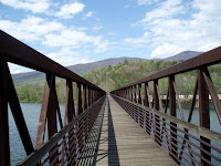
There's a railroad bridge nearby, so I guess that's what folks had to use before the footbridge was built. Reaching the parking lot on the opposite side (on Rt. 501) at 8:45, we had a guy in a pickup truck pull over and ask if we wanted a ride to Big Island - but we were trying for Glasgow (the other direction), so we turned him down, with thanks. Unfortunately (and quite unexpectedly), we then found that there was absolutely no cell phone coverage in the area, and no one else seemed inclined to pick up wet hikers, so we were stuck in place. Then another pair of hikers came out of the woods heading southbound, and also starting thumbing towards Glasgow, a hundred yards up the road, kind of stealing any chance we had for a ride. I sure wished we had gone to Big Island and made a call from there!
After an hour of this we were both wet and cold, so we started hiking towards Glasgow with the intent of getting warm, and getting to a ridgeline to pick up a cell phone signal. About 45 minutes later the two southbounders came up from behind us, doing the same, and just as they passed us, finally another pickup truck pulled over and offered all of us a ride. So we piled into the back and got into Glasgow about 15 minutes later - only to find that the only hotel, both restaurants, and the primary grocery store, were all closed (due to the economy). After asking around, we found that one gas station/mini-mart/deli was the only game in town, so we went over for lunch (which was surprisingly good) and to try and figure out what to do next. We had two choices - resupply, hit the laundromat, and head back out, or get a ride to Buena Vista (a much larger town), our intended stop the next day. Neither Mark or I had much enthusiasm for heading back out (it was still raining), and so after talking it over we decided to take what was behind Door #2.
After getting our groceries at a Dollar Store, we got a shuttle ride from "Legs," a 1995 Through-Hiker who runs his own hiker shuttle service. On the way we stopped at the Post Office, and ended up staying at the Quality Inn. After a quick shower, I had Legs bring me back to the library, where I did some quick emails and one blog report (the library closed at 5:00, so I only had an hour and a half). The weather finally cleared while I was inside. When I got back to the hotel, Mark had done our laundry, and had also laid out all our other gear in the parking lot. Solar System and Naneek, and also Geeza and TopShelf, had also arrived - as was evident from all their wet stuff hanging outside (they had stopped to camp whereas Mark and I had pushed on to Matt's Creek Shelter). They told us that the rain had actually come up through the bottom of their tents overnight - ouch.
After getting our stuff back inside, we hit the Burger King across the street for dinner. There were decent restaurants in town, but all of them were a pretty good hike from the hotel, so we decided to go for convenience instead of quality. Back at the room, we repacked our gear, sorted all our food, and watched some Weather Channel and other TV. A bit later we watched "Saving Private Ryan," it being the eve of the 65th Anniversary of D-Day. Bed around midnight. So, only 2 miles on the A.T. (plus 2 more miles on Rt. 501), and a lot of running around - a very frustrating day! But at least we're good to get back to it tomorrow....
Only 2 miles down to the James River Foot Bridge (which is dedicated for use on the A.T.); this is the longest footbridge on the entire A.T., and it's quite a structure.

There's a railroad bridge nearby, so I guess that's what folks had to use before the footbridge was built. Reaching the parking lot on the opposite side (on Rt. 501) at 8:45, we had a guy in a pickup truck pull over and ask if we wanted a ride to Big Island - but we were trying for Glasgow (the other direction), so we turned him down, with thanks. Unfortunately (and quite unexpectedly), we then found that there was absolutely no cell phone coverage in the area, and no one else seemed inclined to pick up wet hikers, so we were stuck in place. Then another pair of hikers came out of the woods heading southbound, and also starting thumbing towards Glasgow, a hundred yards up the road, kind of stealing any chance we had for a ride. I sure wished we had gone to Big Island and made a call from there!
After an hour of this we were both wet and cold, so we started hiking towards Glasgow with the intent of getting warm, and getting to a ridgeline to pick up a cell phone signal. About 45 minutes later the two southbounders came up from behind us, doing the same, and just as they passed us, finally another pickup truck pulled over and offered all of us a ride. So we piled into the back and got into Glasgow about 15 minutes later - only to find that the only hotel, both restaurants, and the primary grocery store, were all closed (due to the economy). After asking around, we found that one gas station/mini-mart/deli was the only game in town, so we went over for lunch (which was surprisingly good) and to try and figure out what to do next. We had two choices - resupply, hit the laundromat, and head back out, or get a ride to Buena Vista (a much larger town), our intended stop the next day. Neither Mark or I had much enthusiasm for heading back out (it was still raining), and so after talking it over we decided to take what was behind Door #2.
After getting our groceries at a Dollar Store, we got a shuttle ride from "Legs," a 1995 Through-Hiker who runs his own hiker shuttle service. On the way we stopped at the Post Office, and ended up staying at the Quality Inn. After a quick shower, I had Legs bring me back to the library, where I did some quick emails and one blog report (the library closed at 5:00, so I only had an hour and a half). The weather finally cleared while I was inside. When I got back to the hotel, Mark had done our laundry, and had also laid out all our other gear in the parking lot. Solar System and Naneek, and also Geeza and TopShelf, had also arrived - as was evident from all their wet stuff hanging outside (they had stopped to camp whereas Mark and I had pushed on to Matt's Creek Shelter). They told us that the rain had actually come up through the bottom of their tents overnight - ouch.
After getting our stuff back inside, we hit the Burger King across the street for dinner. There were decent restaurants in town, but all of them were a pretty good hike from the hotel, so we decided to go for convenience instead of quality. Back at the room, we repacked our gear, sorted all our food, and watched some Weather Channel and other TV. A bit later we watched "Saving Private Ryan," it being the eve of the 65th Anniversary of D-Day. Bed around midnight. So, only 2 miles on the A.T. (plus 2 more miles on Rt. 501), and a lot of running around - a very frustrating day! But at least we're good to get back to it tomorrow....
Day 62 - A Long Day - Near the James River

Thursday, June 4th - Got up at 5:45, after a terrible night with the biting flies. Whoever picked this spot for a shelter should be forced to live here from May 15th til June 15th every year for all eternity. It rained again overnight, from about 12:30 am til around 4:00 am, heavy at first but eventually fading away to tree-drip. Got out around 6:20, dreary and overcast to start, and stayed that way all day. But (at least) it was dramatically cooler. Passed the first shelter without stopping, and just pressed on.
Had some interesting trail magic today - first, we passed through some pretty impressive "fern-fields," with many thousands of ferns (to the exclusion of virtually any other plant except trees) alongside the trail. In one spot, the ferns were taller than I am, something I don't think I've ever seen before. Second, we also passed through more areas where the rhododendron trees were in full bloom; again, thousands of purple flowers, an amazing sight. And again, other areas where we were walking through tens of thousands of blooming mountain laurels. I'm not sure pictures can do these sights justice, and I hope the readers can appreciate what I'm trying to describe. God's Garden? Finally, coming up over a ridgeline, we had a large doe standing in the trail about 20 feet in front of Mark, wholly uninterested in our presence. Mark finally waved at it at bit, and it wandered off the trail by about 15 - 20 feet, and began grazing (with one eye still on us) as we walked on by. I'm sure we'll see hundreds of deer in the Shenandoahs, but it's still an interesting sight right now.
We came to another shelter (forgot to record the name of it), where Fidget was catching a nap to recover from the night-of-no-sleep at Bryant's Ridge. We also took a break, and chatted with a trail volunteer who was weed-whacking a section of the trail. Among other comments, he warned us that we had very heavy rain expected later this evening and overnight (which we hadn't known, because we couldn't get a signal on the weather band radio down in the hole at Bryant's Ridge). Got out of there soon thereafter (12:50) and pushed on hard. We had a very short but very hard burst of rain right after we left the shelter, but (oddly) that was it for quite awhile.
We had three very tough climbs during the afternoon, the first over Floyd Mountain, then over a ridge, and then another lesser mountain that was more difficult due to our fatigue than the actual elevation. The rain got going around 3:00 pm, then more heavily as we climbed this last hill, but that only spurred us to push harder. We pulled into Matt's Creek Shelter around 7:30, and lucky for us we had pushed - because it was just pouring within 10 minutes of our arrival. Surpisingly no one was there (and no one else showed up for the rest of the night). So, 22 miles today. We are VERY happy to be under cover - as it turned out, we got 6 inches of rain total from mid-day today through mid-day tomorrow(!!!)
Day 61 - The Blue Ridge Parkway & the 750 Mile Mark
Wednesday, June 3rd - Got up at 5:45, surprisingly still clear, with a light breeze (the forecast had called for an overcast morning and thunderstorms late). Again got going around 6:20, nice trail to start (not as good later on). Reached the Blue Ridge Parkway about an hour after we started out, so another milestone passed. We stayed alongside the parkway on and off for awhile, but eventually took a large swing away after mid-day. Kicked out deer three times during the morning, came across a box turtle just off the trail, plus various skinks or lizards, a very large toad, and finally a rather sizable black snake (I got a picture of him).
Got hot again quickly again (which is why we're starting earlier and earlier, to avoid some of the heat at least to start). We're trying very hard to stay hydrated, but it ain't easy when you're humping heavy packs in hot and humid weather. At Bobbitt's Creek Shelter (off the trail by about a quarter mile or so), Mark watched the packs while I went down to get water for both of us. We drank everything we had left, then filled up both liters because the next shelter (Cove Mountain) was listed as having no water at all; not good when it's so hot out.
Started hearing distant thunder, eventually getting quite noisy - but it blew itself out on the ridgeline to our west. Then a second storm redeveloped to our east, but that one also missed us. We stopped for awhile at Jenning's Creek, about a half a dozen hikers there, where Mark semi-swam for a bit (I just waded for awhile). A nice relief from the heat, albeit temporary. Around 4:00 we pushed on to Bryant's Ridge Shelter, really humping it late as (finally) the weather closed in and a shower began to fall; so much for our swim/wade back at the creek. Made it just before the rain got heavy. The shelter is a really nice one (capacity about 20 people), but its placement is terrible - down at the bottom of this dark, wet ravine. Probably due to the mositure, the biting bugs were myriad here, and the shelter register was filled with complaints about them. And with good reason, as we very soon discovered - it was pretty bad overnight. Fidget, Andrew (and his dad and dog), and a couple who we didn't know, shared the shelter with us. We believe that most everyone else stayed at a commercial campground near Jenning's Creek.
The rain faded around 8:00 or so, but the bugs did not. One good note on a personal front; that being, the pain I have been experiencing in my right shin has finally faded away, about 2 weeks after I first injured myself. I can still feel it when I massage my shin, but I'm no longer getting shooting pains down my leg with every step. Thank You, Lord. 21 miles today, and we just (barely) reached the 750 mile mark. A good day, though not such a good night!
Day 60 - Troutville for Brunch & Resupply, then right back out ...
Tuesday, June 2nd - Up at 5:45, clear, 58 degrees, light breeze. As noted in yesterday's report, we were camped at the apex of an old power line or telephone line cut, since abandoned. This was roughly halfway between Lambert's Shelter and Troutville, so we had a 4 - 5 mile hike into Troutville. Got going at 6:20, easy trail, but already hot and getting hotter by the minute. Got to Rt. 220 around 8:45 - very busy place! Troutville is at the intersection of 220, I-81, and Rt. 11, and it was hopping so hard it was actually difficult (and dangerous) to cross the various roads. Stopped briefly at a Sunoco/Mini-Mart for some drinks and to check out the possibility for resupply (as previously noted, these little gas station mini-marts are often superior to grocery stores for short-term resupply, because they sell things in individual packets as opposed to 4's, 6's, 8's, etc., and we only needed about 2 1/2 days' worth).
After a bit we headed down about half a mile to the Shoney's for brunch, managing to avoid getting run over in the process. We found Fidget there (about 9:50), but he was already leaving - apparently his 10:30 invite was mis-dated; he had meant the previous day. "Oh well." Anyway, for the first time on this trip I managed to out-eat Mark at an all-you-can-eat buffet (it was more than pretty good). Mark called his mom to reassure her that we had made it and that Mark's new boots were working out for him. We spent an hour there, then headed across the street to the Dollar General, but they didn't have a lot of individually packaged stuff, so we ended up buying about half of what we needed there, then returned back up the street to the Sunoco for the rest. Quite hot by this point, and even more traffic.
Back on the trail at noon, walking through pasture-lands for a bit, with loud traffic noise from I-81 closely nearby (kind of a jarring disconnect and contrast). The open areas were saunas. Eventually we got back to the "actual" woods, and continued on to the Fullquart Knob (sp?) Shelter - no spring there, but rather a cistern system that collected water off the roof and purified it. Well, it was rather brownish, so I collected a liter and purified it twice, but decided to keep it in reserve - hopefully I'll be able to find something more appealling down the trail! Pushed on to the next shelter, passing Salt Pond Road (the 726 mile point, one third of the way to Katahdin!) on the way. Someone had scraped an AT symbol into the gravel there, which was kind of cool looking. Also we ran into Solar System and Naneek there, and Solar System was giving away large chocolate chip cookies that here grandmother had mailed to her (we got 2 each; they were pretty good). An unexpected trail magic (especially for a Tuesday)!
Came across a few creeks soon thereafter, so I used the brownish water from the last shelter to give myself a quick shower (head only), which felt most excellent, and refilled with better looking water. Pushed on to Wilson Creek Shelter; nice spot. The shelter only had two people inside, and maybe 8 more were camped around it, due to the number of biting bugs - a growing problem - we also tented it. Chachee and the Birds came in a bit later. I went down to the creek and gave myself a minor (and private) bath, and also washed my clothes, both issues being badly needed. "Slowly" walked back up the hill to avoid breaking a sweat. In all, probably 15 people were at the shelter by 8:30. Mark went to bed around 7:45, but I stayed up a bit longer to do recording and hang up wet laundry, etc. It was a pleasant night, but unfortunately interrupted regularly by those night birds (whipporwills?) that sing all night long, with a very loud and very distinct call; not good for a light sleeper! But clear, and with a light breeze. Total today, about 16 miles.
Friday, June 5, 2009
Day 59 - Back on the Trail, MacAfee Knob & Tinker Cliffs
 Monday, June 1st - Got up at 6:30, earlier than needed, but wanted to check email one
last time, plus I need to finish packing (Mark had done most of his packing the night before). No emails, which was a bit of a surprise. Weather.com for this area shows a nice stretch, but quite hot. Mark came up around 7:45 and we ate another large breakfast courtesy of Mark's mom. A good meal for the trail. Finished packing and headed back to the 311/Catawba interchange around 8:45, arriving around 9:20 or so. Not surprisingly, many fewer cars in the parking lot this morning - a Monday - than when we first arrived on Saturday. Left at 9:30, with many wishes of "Good Luck" and "Be Careful" from Mark's mom and aunt.
Today's trails and hiking were probably our best of the trek so far - very even trails, and beautiful weather. MacAfee Knob is sort of the Old Rag of this area, and is a very popular climb - so the trails were created with tourists and day-hikers in mind (picture a 4-lane highway). Nice for us too. Quite a contrast to the life-threatening trails leading from the Dragon's Tooth on Saturday! It took us roughly 2 hours to get to the Knob, bypassing two shelters along the way. The actual Knob was everything it was promised, a just spectacular vista of the local mountains and valleys. Not surprisingly, the view from the Knob itself is allegedly the most photographed overlook on the entire Appalachian Trail - and we got several photos, courtesy of a local family who happened to be there when we arrived (I sent Pete one from my phone - see above).
After about a half an hour, we pushed on, stopping for lunch at the Campbell Shelter (and also entering ourselves in the Register there). Then we had a rather frustrating time at Tinker's Cliffs, another landmark spot. Apparently the trail doubles back on itself before going up on the top of the cliffs; well, we (and many dozens of others) missed this - it was VERY poorly marked - and instead we struggled around the bottom of the cliffs on a false but well worn trail. As a guess we were about 20 feet left and 20 feet down from the "actual" A.T., and it was QUITE a struggle. We finally reached the end of the cliffs, and I (finally) insisted that we return to the starting point and figure out what we had done wrong. Then Mark noted a pair of blue blazes on the rocks next to a steep cleft in the cliffs, and 30 feet later - voila! - there was the A.T. again, with a blaze right there in front of us. To put it mildly, we were both furious - especially me. We have had hundreds if not thousands of blazes where none were needed, but here was a critical spot that was reduced to pure luck. [We learned the particulars from other hikers later, only a few of whom lucked into it on arrival.] But I supposed we saw an unusual, and far harder section, of the A.T., than intended.
Continuing on, the trail down was equally gentle, and we stopped at Lambert's Meadow Shelter, where we saw Kan-Do, who we had seen 3 days before. After a brief chat, and some water, we continued on with the intent of tent camping (no shelters for another 10 miles). Around 6:30 or so (5 miles after Lamberts), we came to a cut that appeared to have been a power line cut or old road - nothing there now, but I suggested to Mark that we camp at the apex, about 150 feet up from the A.T., and we did indeed find a small level area at the very top that was just barely large enough for our two tents. So we planted it for the night, 15 miles in. Upon inspection, we found that an old version of the A.T. (long closed off) had once come out right where we were camping. So tomorrow we're heading to the 220 interchange (about 4 miles) for breakfast/lunch at Shoneys, plus food resupply, then back out again.
Monday, June 1, 2009
Day 58 - A Surprise Wet Wakeup & a Day of Rest
Sunday, May 31st - Woke up at 4:25 am, when Mark asked: "Hey Bob, was that thunder?" A couple of seconds later we got a confirmational boom, and quickly dressed and got outside (in the rain) to bring in all our gear, all wet once again. Fortunately this QUITE unexpected storm passed by about 2 miles to the side, so our stuff was wet but not soaked (for which we were duly appreciative). After that 10 - 15 minutes of excitement, I was unable to sleep until about 6:30, and so finally got up around 8:15 am - one of my latest wakeups of the trek.
Mark's mom fixed us some breakfast while Mark perused the yellow pages for outdoor outfitters in Roanoke and nearby (the most promising were out of business, but there was one in Roanoke that opened at 11:30 am). I spent a few minutes taking all our stuff back out of the basement, laying everything back out in the sun, and then hosed out my pack. I then spent some time on-line, and found that Marco had re-set my password, so I sent him a list of gear I needed forwarded up the line (some of my clothing is coming to pieces after the wear and tear of the past 8 weeks, plus I needed to replace the pair of socks and underwear that I had left at the Rice Field Shelter (I'm sure the hikers behind them REALLY appreciated that little bit of Trail Magic...).
We headed off to Roanoke just before noon, taking some time to get around a street market/festival and find the outdoor store; nice place but very limited selection, so we ended up going to a Dick's Sporting Goods nearby, where Mark bought some medium/low ankle Merrills that were considerably more comfortable on his feet. Hopefully this will help on the blister front. We ate a late lunch/early dinner at the Golden Corral, and quite a feast it was, too! Got back around 4:00, and started in on some blog reports for Pete. Typed reports til 7:30, and called it a day. Meanwhile, Mark chatted with one of Essie's friends who came by to talk about the trail. I think we'll risk leaving our gear out tonight - but maybe not!
Once I finished typing up and sending the blog reports, we had a light dinner courtesy of Mark's mom, and discussed our upcoming resupply points. We're able to resupply regularly for the next week or so, which will certainly keep our pack weights down versus last week. I also chatted with Essie's friend John about our food and gear; as a previous hunter, he was very interested in how we were living on the trail. Once dinner was over we headed over to a nearby Kroger's grocery store and bought a few things to carry us through to Troutville on Tuesday mid-day. We also noted that Mark's mom's car had a major radiator leak, something she'll take care of tomorrow; hopefully it's just a hose and not a water pump or some other really pricey repair. Back at the house, we sorted food and gear and laid things out for our departure tomorrow; Mark fully packed but I left things unpacked to give my pack another 8 hours to fully dry out. Checked the weather forecast - Monday and Tuesday both clear but hot (near 90 on Tuesday), then increasing chances of afternoon thunderstorms on Wednesday and Thursday. After a little more TV (the Nationals lost again), bed by 11:00. Back at it tomorrow....
Day 57 - Into Catawba and a Break at Mark's Aunt

Saturday, May 30th - Up at 5:45, clear but chilly - 46 degrees - with a gentle breeze. Still pretty humid, and the stuff we left out overnight did not noticeably dry, so another day starting out in wet clothing. Since we tented (up the hill from Pickle Branch Shelter), and had various items hanging out, it took a little longer than usual to get going, but we finally left at around 6:30. Ran into Criqui just as we reached the access trail from the shelter, and so he joined us for a couple of hours. He had reached the shelter about 45 minutes after we had last night, but rather than camp he just slept on the picnic table instead; lucky for him it didn't rain.
The breeze picked up as we got back to the A.T., and it was clear that the long-awaited front was pushing through. Today's hike took a roundabout course to get to an unusual rock formation, the Dragon's Tooth , a spire of stone about 50 feet high at the end of a ridge. It was interesting, but the trail leading to it and then (especially) past it was probably the most challenging and actually dangerous section that we had faced on the trail to date. At various points we were basically "rock hopping;" at others we were climbing down rungs in the face of the rock, and at still others we were very carefully picking our way across thin ledges over a 25 foot drop. [Criqui and another hiker "Witness" left us behind pretty quickly once we passed the Tooth, and we also met various hikers coming up - the Tooth is sort of the Old Rag of Roanoke.] It was exhausting work for Mark and I, and took over 2 hours to make less than a mile - hard work and a long way out of the way to go see a rock formation!
Continuing on, a lot of ups and downs today, nothing super-tough, but a couple of pretty stiff climbs, especially after lunch. Water was also a bit of a concern (again), as the only creek we passed was running brownish and had lots of leaf debris in the current. Another consequence of all the rain from the past 5 days. We finally reached another stream that seemed better than anything else we had seen, and grabbed a liter each there - good thing, as there was nothing available for the rest of the day's hike. After traversing about a mile of pasture (and staring down a half a dozen Angus cattle, and traversing about 8 cattle guards, including one that was electrified (how very exciting!)), we climbed the last ridge of the day, many ups and down and more rock-hopping along the ridgeline spine, more tough going. We had to turn around one group that was looking for McAfee Knob (a rather famous scenic area here); they had come south off the parking lot instead of north, and so were about 5 miles wrong. Not positive they believed us, though....
We reached the parking lot at Rt. 311 at 2:55, where Mark's mom and aunt (Essie) were already awaiting our arrival. So just under 13 miles for the day, but (honestly) a pretty tough day nonetheless. We laid some blankets on the back seat to minimize fouling her car, and quickly left for Aunt Essie's house in Cave Spring, about a 20 minute drive. Once we arrived, we immediately emptied our gear on her back patio, which was still in bright sunshine, and I took the opportunity to hose out my boots, orthodic inserts, rain gear, and several other items that were distinctly "reeking." Then a very badly needed shower. After a break for some drinks, we later did our laundry, set out the GPS "Spot," and sent Pete about half a dozen photos from my camera, dating all the way back to Trail Days (while we were relaxing on the porch). I also called Joe at Casual Adventure and ordered a replacement hipbelt and shoulder straps for my pack, to be picked up in about 3 weeks when I get to Harpers Ferry (and take a couple of days off). A groundhog and some bluebirds kept us company while we were on the porch.
Eventually we headed off to dinner at Country Cookin', a combination buffet and menu restaurant (order entrees off the menu; everything else was all-you could eat off the buffet). We also hit a CVS to grab some Liquid Skin and other blister bandages for Mark's feet - either his feet have widened, his boots have shrunk, or the inserts have expanded from all the wet, and so he is getting a sizable number of blisters (this is the first time either of us have had this problem). Back at the house, I was unable to log onto my email account, so I ended up calling Marco and asked him to re-set my password. Also discussed a few other minor house issues, including a sizable tax bill from Arlington County - apparently my new mortgage company did not pay the taxes out of my escrow, so something else to figure out and fix in absentia. Hmmmmm....
Mark bandaged his feet, and determined that his current boots were just not going to work anymore, so we'll be buying new boots tomorrow somewhere. Bed around 9:30; Mark watched a bit of the latest Nationals loss, but I fell asleep pretty quick. A good day, but the long side-hike to the Dragon's Tooth really took it out of us.
Subscribe to:
Posts (Atom)